Eng-Tips is the largest engineering community on the Internet

Intelligent Work Forums for Engineering Professionals

  • Congratulations waross on being selected by the Tek-Tips community for having the most helpful posts in the forums last week. Way to Go!

A Question as to whether "this" is surveying 4

Status
Not open for further replies.

BigH

Geotechnical
Dec 1, 2002
6,012
0
0
TJ
It seems that a lawsuit has been filed against the North Carolina Engineers and Surveyors regarding a non-surveyor flying drones over properties so that people can "see" what their property looks like - as for perhaps adding on new facilities or a building or pool or pond? The owner of the photography business has clearly indicated that his work is "not for legal purposes". One such case involved a company wanting to see where they are losing heat - a thermal rending of their facility. The NC E&S says that this is "surveying" and have threatened legal action against the drone/photography business owner.

Just wanted to know my colleagues thoughts on the issue - if not for legal work such as property lines and the like, is this man contravening the professional surveyors' rights?


As an interesting sidenote, in another thread, a contractor built a wood retaining wall for a client and there may be issues with the fact that retaining wall may not be safe. Did the Contractor practice, then, engineering?
[cheers] to all
 
Replies continue below

Recommended for you

North Carolina Code:
§ 89C-3. Definitions. said:
(7) Practice of land surveying. -

a. Providing professional services such as consultation, investigation, testimony, evaluation, planning, mapping, assembling, and interpreting reliable scientific measurements and information relative to the location, size, shape, or physical features of the earth, improvements on the earth, the space above the earth, or any part of the earth, whether the gathering of information for the providing of these services is accomplished by conventional ground measurements, by aerial photography, by global positioning via satellites, or by a combination of any of these methods, and the utilization and development of these facts and interpretations into an orderly survey map, plan, report, description, or project. The practice of land surveying includes the following:

1. Locating, relocating, establishing, laying out, or retracing any property line, easement, or boundary of any tract of land;

2. Locating, relocating, establishing, or laying out the alignment or elevation of any of the fixed works embraced within the practice of professional engineering;

3. Making any survey for the subdivision of any tract of land, including the topography, alignment and grades of streets and incidental drainage within the subdivision, and the preparation and perpetuation of maps, record plats, field note records, and property descriptions that represent these surveys;

4. Determining, by the use of the principles of land surveying, the position for any survey monument or reference point, or setting, resetting, or replacing any survey monument or reference point;

5. Determining the configuration or contour of the earth's surface or the position of fixed objects on the earth's surface by measuring lines and angles and applying the principles of mathematics or photogrammetry;

6. Providing geodetic surveying which includes surveying for determination of the size and shape of the earth both horizontally and vertically and the precise positioning of points on the earth utilizing angular and linear measurements through spatially oriented spherical geometry; and

7. Creating, preparing, or modifying electronic or computerized data, including land information systems and geographic information systems relative to the performance of the practice of land surveying.

b. The term "practice of land surveying" shall not be construed to permit the design or preparation of specifications for (i) major highways; (ii) wastewater systems; (iii) wastewater or industrial waste treatment works; (iv) pumping or lift stations; (v) water supply, treatment, or distribution systems; (vi) streets or storm sewer systems except as incidental to a subdivision.

If all he was doing was taking aerial photos and maybe even throwing in some thermal imaging, that's fine. But if you start mapping out topography, I'd say that certainly infringes on the definition of "Practice of land surveying."

Approaching this from a 1st Amendment angle is troubling. It feels more like an attack on the entire licensing system than it does on this one case. At what point does it become a matter of free speech that Joe Schmuckateli can tell Billy Joe Bob what size beam he needs in his house? The potential precedent ramifications could impact all of us.
 
Any Joe Schmuckateli can already to that, though convincing a contractor to proceed on that information should be unlikely. Similarly, parents can do haircuts and shampoos on their children without a beautician's license.

The place that it stops is liability and legal acceptance. If a guy with a drone maps out a property, that map won't be accepted by courts and therefore anyone likely to be in court over some dispute. Fence companies, building permits, mortgage lenders, title insurance - none of them will take this as a legal document.

This is similar to the Oregon case where a guy used arithmetic to show the yellow light duration was far too short and the licensing board of engineers went after him because the calculation involved traffic controls. And then they lost, because his calculations weren't the basis for any change to them; the official calculations still were required by a licensed PE to make that change.

I can see where the loss of potential income is a problem. The farther one gets from danger-to-life licensing, the more it's for keeping the competition out. Pilots of helicopters and small planes see their aerial photo business cut back, so they press to have drone pilots go to considerable time and expense to be allowed to sell photos (or even post a YouTube video that YouTube might place an advertisement on, because even when the video maker gets no compensation - still "commercial use.")

I wonder where this leaves satellite owners who produce images for such entities as Google Maps. Or is that different because they can fight back?

 
This is not surveying. If the drones were lidar equipped for producing a site plan, it might be considered as such... but, I'm not sure. As long as there is no legal representation of the photos, or drawing, I would suggest it's not surveying. What the professional organisations rule on this matter is another issue.

Rather than think climate change and the corona virus as science, think of it as the wrath of God. Feel any better?

-Dik
 
It seems to me that if the drone photography was used to prepare a plan with dimensions, elevations, measurements, or structure locations, it is surveying. If the drone produced photos for informational purposes and discussion, it is photography. Otherwise, no one would be allowed to take pictures from an airplane or high tower.

 
Pretty much what I thought...

Rather than think climate change and the corona virus as science, think of it as the wrath of God. Feel any better?

-Dik
 
I agree that if it were JUST photography he'd be fine. But the articles specifically point out that he's providing mapping services with elevations. That is what photogrammetry is (using photographs and/or recordings to determine physical attributes such as dimensions, elevations, etc.), and photogrammetry when used on a piece of land is covered under the NC statue for what constitutes land surveying.

I disagree that this is like the Oregon case. In the Oregon case, the person accused of practicing without a license did the work for himself and presented his opinions at a government meeting. In this case, a BUSINESS is offering services to the PUBLIC for a FEE doing something that is pretty clearly mentioned in the regulation as practicing land surveying (number 5 in the quote above). The regulations aren't just about making sure that our work products stand up in court (though it does feel like it sometimes). The primary purpose for a licensing requirements is consumer protection. The vast majority of people aren't going to know the difference between the information this company provides and what they'd get from an LS.

 
Are all state rules written as broadly as the one in NC?
So if I help my neighbor make a few grade measurements for some drainage work I have violated the law?
I agree the fact that is a for-profit business is a bit different.
And that this is work that traditionally would have been done by surveyors.
If they deny the use of new technology and dig their heels in they will win this battle and lose the war.
They really need to decide where this fits.
Air based LIDAR is getting easy and less expensive. If I have a pay a guy with a license a few hundred bucks just to use it that might work. But someone with a large project will fight it and win.

= = = = = = = = = = = = = = = = = = = =
P.E. Metallurgy, consulting work welcomed
 
Ed - not sure. I had to look up the NC regs to get that much. I'm a NC PE, but working in structural I don't need a working knowledge of all the surveying regs on a daily basis.

What piqued my interest was the general approach to the lawsuit. I suspect the group backing the suit (it sounds from the articles as if the business owner is not paying for it himself) has an agenda that reaches beyond surveying. It sounds like they're trying attack the entire system of professional licensing.

I won't argue with a stance of it needing reform - there are certainly things that could be done better. But attacking license requirements as a 1st amendment issue feels like using a chainsaw where sand paper would be the better tool.
 
As in the case of the traffic analysis, I think the IJ is looking to rein in overzealous licensing boards overstepping a vague and overly broad law.

Even in the cited example of stitching together a photomosaic basically results a digital clay model, hardly a legally valid/binding documentation of anything. Even in the case of airborne lidar for creation of 3D models, unless it's specifically tied to the same level of lat/long accuracy as a conventional survey, it's meaningless for the purposes of establishing property boundaries, etc., which is what surveying is primarily about. Anything beyond that smacks of restraint of trade; I get they want to carve out a chunk for their licensed engineers, but it's carve-out and protectionism of the worst kind

TTFN (ta ta for now)
I can do absolutely anything. I'm an expert! faq731-376 forum1529 Entire Forum list
 
NC should also go after Google and Bing if they want to be consistent with going after a drone photographer. Might as well go after the Federal government and every other nation that has satellites taking photos.
 
In my opinion the services he is offering and missing out on is surveying. In my jurisdiction for engineering purposes I can only legally obtain drone or lidar services from registered surveyors with surveyors professional insurance. I believe the distinction is that by selling a map which contains coordinates and elevations allows the customer to use it to do engineering by laying out buildings in 3d, plan cut and fill areas, or plot boreholes and draw sections.

Now I actually have a google earth problem, I have seen reports from competitors which use google earth elevations to perform feasibility level hydraulics. To which I comment to my clients that I will not be relying on the topography from Google Earth to perform any engineering and they can either get lidar/drone mapping for there property or we will use government baseline mapping which is a slight step up from google earth but it has been furnished by the government.
 
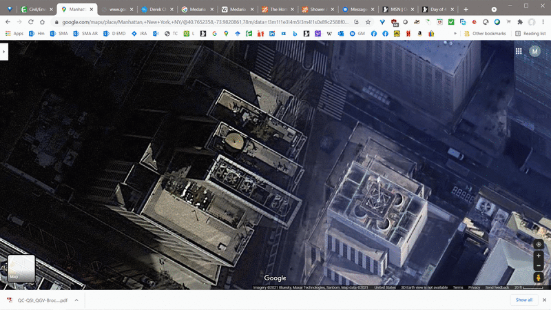
There are a couple of other reasons to avoid Google Maps/Earth for anything serious, see below. Also, Note that satellite imagery is often shot at oddball angles, so perspective is warped, and finally, the placement of features is no more accurate than around 10 meter SEP

google_map_glitch_k780dp.gif


TTFN (ta ta for now)
I can do absolutely anything. I'm an expert! faq731-376 forum1529 Entire Forum list
 
So here in Illinois, the one exception for requiring a PLS is topo by an PE supporting their own engineering project - no standalone topo work. I'd say the drone service would be a violation here, regardless of a disclaimer if topography or property lines were shown.

(225 ILCS 330/5)
3) performing topographic surveys, with the exception of a licensed professional engineer knowledgeable in topographical surveys who performs a topographical survey specific to his or her design project. A licensed professional engineer may not, however, offer topographic surveying services that are independent of his or her specific design project;
 
Again, that just kicks the can down the road; ostensibly, "topographical survey" has a VERY specific legal connotation. As such, a photographic survey is NOT a "topographical survey," since it is fundamentally no different than someone taking pictures of the ground while flying in an airplane.

[URL unfurl="true" said:
https://www.partneresi.com/services/land-surveying-mapping/topographic-surveys#:~:text=A%20topographic%20survey%20locates%20all,all%20natural%20features%20and%20elevations.&text=Specifically%2C%20it%20shows%20their%20location,and%20any%20changes%20in%20elevation.[/URL]]TOPOGRAPHIC SURVEYS
A topographic survey locates all surface features of a property, and depicts all natural features and elevations. In essence it is a 3-dimensional map of a 3-dimensional property showing all natural and man-made features and improvements. Specifically, it shows their location, size, height and any changes in elevation.

TTFN (ta ta for now)
I can do absolutely anything. I'm an expert! faq731-376 forum1529 Entire Forum list
 
IRstuff - the issue is that the subject of the article was not just taking pictures. He was providing elevation data to go along with it. If he were just taking pictures, that's fine - lots of people do it and there's no issue as long as you have a the necessary drone operators licenses. But he's using data in the photographs - whether LiDAR or other programmatic post processing of the photographs to generate 3d data for the ground surface. That is specifically called out in the North Carolina regulations as surveying.

The wording in the law governing this individual/company is pretty cut and dry (see my post with bold #5 above). If there's a discussion to be had here, I think it's on the merits of the law itself and, perhaps, the merits of current licensing systems in the US. Because that's what this is going after. It's claiming that it's a violation of a persons Constitutional rights to prevent them from providing information and/or opinions about a subject that is currently the purview of only licensed individuals.
 
Status
Not open for further replies.
Back
Top