Continue to Site

Eng-Tips is the largest engineering community on the Internet

Intelligent Work Forums for Engineering Professionals

  • Congratulations GregLocock on being selected by the Eng-Tips community for having the most helpful posts in the forums last week. Way to Go!

Google Earth Rewrites History 2

Status
Not open for further replies.

BUGGAR

Structural
Mar 14, 2014
1,732
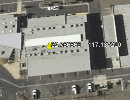
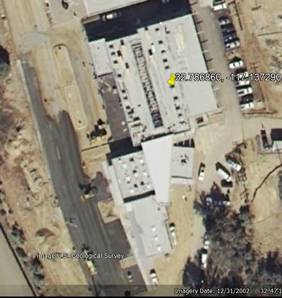
I’ve been undertaking a hydraulic study of some canyons in San Diego and I have found a structure on Google Earth that is not there in reality. It is located at Google Earth Coordinates lat. 32.786860, long. -117.137290. I live across the canyon from this building and it is not there! If you trace back in Google Earth history, the building is still shown there back to the early development of this property. The image appears to have been edited to add this structure.
The owner of this “structure” is a large utility and this property has erosion problems that I have been studying (see creek west of the substation). I believe this structure is part of their “proprietary” facility expansion which has avoided being placed on recent EIR’s as well.

Can powerful entities control Google Earth?

 
Replies continue below

Recommended for you

Are you having an issue with all of the 'buildings' on this site or just some of them? I checked Apple maps and it appears that the same structures are there. And the image is NOT the same as seen on Google Earth as it appears that it's a different time of day and perhaps a different season of the year, and besides, the cars around the buildings are different.

Are you sure that you're looking at the correct place? If this is a 'photo-shopped' image, it's very complex and the consistency between the Apple and Google images, in terms of the actual structures and outbuildings, is very very close, right down to the number of HVAC units on the roofs of the buildings.

John R. Baker, P.E. (ret)
EX-Product 'Evangelist'
Irvine, CA
Siemens PLM:
UG/NX Museum:

The secret of life is not finding someone to live with
It's finding someone you can't live without
 
If you look at Google Earth history back to 1994, they show the building at the coordinates given. It appears as a three dimensional image on the areal in 1994 and I know that it was not there in 1994. Does your Google Earth show this as an added image? I have found that this building and a lot of other work is missing from several EIR documents.
 
I forgot to mention that I have early Google Earth photos that do not show this building. And now it's there overlain on the old!?
 
Have you tried to confront Google with this issue?

John R. Baker, P.E. (ret)
EX-Product 'Evangelist'
Irvine, CA
Siemens PLM:
UG/NX Museum:

The secret of life is not finding someone to live with
It's finding someone you can't live without
 
Seems like it can be seen in street view at (32.7907704, -117.1348381)
 
The problem is that it can be seen (superimposed?) in the images all the way back to 1994 (the historic time limit), and my old Google Photos used earlier for hydraulic studies did not show this structure.
This is significant because several EIR's did not include data on this development and now it suddenly appears as if it has been there all along. I am putting together a photo log which will likely go legal. The question: Does a document such as a Google Earth Image, that has been modified to change the historical time frame, void its use in an EIR when the time frame is relevant?
I have found Google to be impenetrable. Does anyone have a contact? Thanks.
 
I do not know how long Google earth keeps its images. If you look at my house today on Google earth it shows a large tree between the sidewalk and the street. The city cut that tree down two years ago.
B.E.

You are judged not by what you know, but by what you can do.
 
I need a reality check. If someone could please go to the coordinates I gave and go back in history to 1994. Is the building there? On my Google it is superimposed and also visible as the only 3d object in the image when you do a 3d pan.
Why would they project an image into the past?
 
Are you saying the building doesn't exist today or it didn't exist in 1994? Multiple aerial images show it existing today, I don't think that's a question. I believe the 3D building functionality of Google Earth is open source. You can turn off the 3D buildings (there is a check mark in the menu on the left). The 3D building is shown in 1994, but if you turn off 3D buildings, you can see that it wasn't part of the aerial image. I imagine it's more likely a mistake from whoever added that 3D building to Google Earth rather than something nefarious though...
 
chris3eb, the building did not exist before 2010 as confirmed by my old report images. I think you hit it when you said it may have been a Google mistake. I have my little case prepared and I will see what the lawyers say. It really looks on the surface like they are trying to say "That building was here along, we don't need no stinkin' EIR!".
 
Google Earth has 13 aerial images from 2003 until 2009 that show that building (assuming we're talking about the same building). It seems pretty unlikely that they either got the date wrong on all of these images, or willfully altered them.
The mistake that I was talking about is showing an open-source (ie not added by Google) rendered 3D model on an old map - a pretty easy mistake to be made.
Also, you should probably be a little more careful with your words if you want to get people to buy into this theory. At first, you said:
BUGGAR (Structural)(OP) said:
I live across the canyon from this building and it is not there!
But now you are saying:
BUGGAR (Structural)(OP) said:
building did not exist before 2010
I assume in the first quote, you meant that it wasn't there at a certain time, but it's easy to discount your entire theory if you say conflicting stuff like that.
 
"I assume in the first quote, you meant that it wasn't there at a certain time"
You are correct.
I am leaning towards a Google error but how does that happen? If you look closely, the latest photo shows an actual building, while early the historics show a schematic.
Sorry to be a drag here but this is driving me crazy. And now we shouldn't trust Google Earth for hydro studies?
 
You can turn off the 3D building, in which case GE shows the building being there in Mar 2003, including some pretty ratty images where it was either dark or cloudy. It was not in the imagery in February 2003, so pretty tough to explain how a building pops up in a month. Interestingly, this coincides with reports that certain satellite imagery is manipulated to prevent people from seeing classified installations and bases. Perhaps this is a CIA black site and we'll be visited by gentlemen in dark glasses momentarily.

Great mystery!!

ghost_building_jhilft.gif


TTFN (ta ta for now)
I can do absolutely anything. I'm an expert! faq731-376 forum1529 Entire Forum list
 
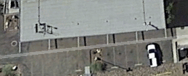
Another image from Oct 2012; whoever doing it still can't get the shadows correct. They can't seem to keep the building stationary, as well. Note the location of the building keeps moving relative to the painted parking space lines

ghost_building_Oct_2012_dafn6p.gif


TTFN (ta ta for now)
I can do absolutely anything. I'm an expert! faq731-376 forum1529 Entire Forum list
 
I saw a clearly fake image superimposed on the 1994 view. Right clicking on it brings up the option to hide it. Gone.
 
Those "parking stripes" in contact with the building appear to be rafters that extend from the edge of the roof, and that are casting dark shadow lines onto the pavement. The shadows are consistent with the angle of the sun and other shadows.
 
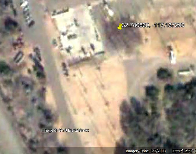
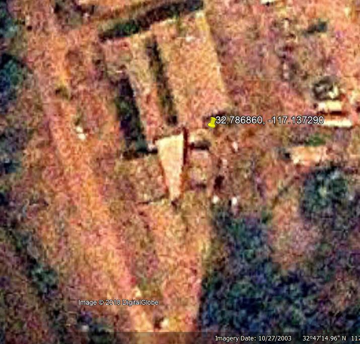
I guess Google is not as infallible as initially assumed. The following aerials are dated March 3, 2003; March 10, 2003; October 27, 2003 and December 31, 2003 (note that the last one shows 2002 on the bottom of the page, but the top of the page says 2003...). Obviously the building didn't get entirely build between March 3 and March 10. The March 10 image is exactly the same as the December 31 image, so presumably the March 10th one was also mistakenly added. It still seems like a bit of a stretch that ALL of the other images between 2003 and 2010 are wrong, but if there are demonstratively multiple mistakes with Google Earth (the 3D rendering showing on the 1994 maps, the duplicate image 9 months apart, the wrong year on the 12/31 image), then maybe BUGGAR can demonstrate it just shouldn't be trusted...

2003-03-03_lsbzq0.jpg

2003-03-10_rnxtjd.jpg

2003-10-27_zhbik3.jpg

2003-12-31_rf01kd.jpg
 
After some additional research, I have found the following:

This facility is the San Diego Gas and Electric Mission Control Center for San Diego and the surrounding areas. It appears that the “Mystery Time Travelling Building” is part of the Utility’s Master Expansion Plan. In my research of relevant documents and depending on the time frame, this Plan appears to have been omitted in EIR’s that were recently issued for several significant projects in this area. This omission would be significant because this expansion will add over 100,000 sq. ft. of offices and training facilities, plus an undetermined amount of parking to an area of San Diego congested with traffic. As can be seen in the Google Earth Images, there is also severe erosion at this site as well as other environmental issues. But this does not explain why they would show a schematic of the building in the wrong time frame. This can affect hydrological studies if you don’t know when that hardscape has been added. I noticed this anomaly while undertaking a watershed study and I wonder if another Engineer perhaps did not catch this in their studies?! At the very least, I believe it is important to be aware of this and I share it accordingly.
Although I believe this anomaly to be a Google error, the schematics for the “Mystery Travelling Building” must have been supplied by the Utility (unless Google does Architecture now). I can’t explain that yet.

 
Status
Not open for further replies.

Part and Inventory Search

Sponsor