Joni_DeWolf
Civil/Environmental
I was wondering if my HydroCAD model for stone check basins within a swale is correct.
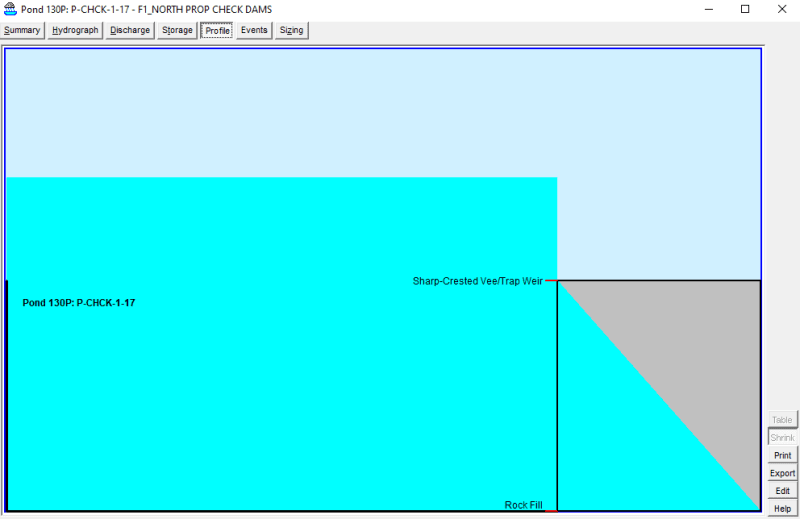
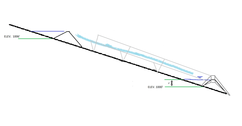
I have a series of pond-reach-pond-reach-pond-reach... to model 16 check dams. However I do not know if I am doing the storage and outfall routing correct. For my ponds I have detention pond with custom stage data as storage and rock fill as primary outlet and sharp crested trap weir as secondary outlet.
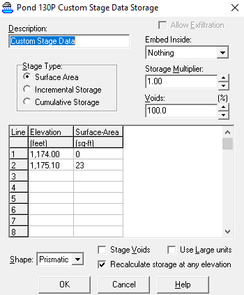
For my storage im using surface area with 0 sqr ft at the base elevation of the check dam and 23 sqr ft at an elevation 1 foot higher. Is that my total storage since my check dam is 1 foot high?
For my outlets I have Rock Fill with its invert at the base elevation and then a length of 6, breadth of 1, and height of 1. (Rock dia=6 , SD=0.1) THEN, for my secondary outlet I have a trap weir with a crest length of 6 (to match the check dam) and a rise of 1 (so that there is an open gap where the check dam is). I am trying to use the weir to model the water that flows over top of the check dam. Is this the correct way to model this?
Here are my stage discharge graph and hydrograph
![URL]](http://- [URL unfurl="true"]https://res.cloudinary.com/engineering-com/image/upload/v1724344026/tips/stage-discharge_nm9afk.png[/URL])
![URL]](http://- [URL unfurl="true"]https://res.cloudinary.com/engineering-com/image/upload/v1724344035/tips/hydrograph_b2etwf.png[/URL])
I have a series of pond-reach-pond-reach-pond-reach... to model 16 check dams. However I do not know if I am doing the storage and outfall routing correct. For my ponds I have detention pond with custom stage data as storage and rock fill as primary outlet and sharp crested trap weir as secondary outlet.
For my storage im using surface area with 0 sqr ft at the base elevation of the check dam and 23 sqr ft at an elevation 1 foot higher. Is that my total storage since my check dam is 1 foot high?
For my outlets I have Rock Fill with its invert at the base elevation and then a length of 6, breadth of 1, and height of 1. (Rock dia=6 , SD=0.1) THEN, for my secondary outlet I have a trap weir with a crest length of 6 (to match the check dam) and a rise of 1 (so that there is an open gap where the check dam is). I am trying to use the weir to model the water that flows over top of the check dam. Is this the correct way to model this?
Here are my stage discharge graph and hydrograph