Eng-Tips is the largest engineering community on the Internet

Intelligent Work Forums for Engineering Professionals

  • Congratulations waross on being selected by the Tek-Tips community for having the most helpful posts in the forums last week. Way to Go!

Reference manuals for sewer rising main geotechnical investigations

Status
Not open for further replies.

geotechguy1

Civil/Environmental
Oct 23, 2009
644
0
16
NZ
Does anyone know of any reference manuals or design guidance that cover geotechnical investigations for sewer rising mains (and also other types of linear civil infrastructure like water transmission / stormwater). I'm thinking along the lines of the EPRI guidance for geotech investigations for electric transmission
 
Replies continue below

Recommended for you

Its all very asset owner dependent. We are doing a 180km long cable at the minute with boreholes every 5km with CPTs every 5km in the middle of BHs.

We have done 30km pipelines with a BH every 1km.

Our work is always accompanied by geophysics so it removes some doubt.

EC7-Part 2 states for liner structures (roads, rail, channels, pipelines, dikes, tunnels, retaining walls) a spacing of 20m to 200m is a guideline.
 
Bores every 5km isn't very good, if not accompanied by requirements to do additional bores at visible indications of change in soils, or geologic and structural inconsistencies.

Einstein gave the same test to students every year. When asked why he would do something like that, "Because the answers had changed."
 
Buried pipelines/cables with proper assessment are relatively low risk. Most issues are from human interference which is mainly fishing or anchoring.

With CPTs every 2.5km and geophysics calibrated to BHs it is considered sufficient.

Also, we dont scope the investigation. They come to us with scope and investigation layout.

Out client has many thousand kms of pipelines and cables laid in the region so they have likely determined its sufficient.
 
It's not the long term risk to a pipeline that is so important, except for corrosion, but the better definition you will be able to pass on to the construction contractor as to what type of soil lays below and what effort will need to be expended during excavation in soft, hard soil or rock, if blasting is required, and the presence of other geohazards, such as karst formations, faults, slope instabilises, erosion susceptible soils, high water tables, river bed materials, location of nearby approved sand deposits, etc. If its 180km of more or less uniform, flat or slight rolling farmland, 5km might indeed be good enough, otherwise that could present a very granular picture and the contractor could fill in those blank spots with higher prices, or hit you up for extra payments later when unexpected rock appears. For me, it's more about reducing construction cost risks and a few more boreholes and test pits are usually well worth their cost, even if it confirms the obvious. It's easier to negotiate better prices with confirmed data in hand. [pre][/pre]

If you all are happy with 5km, so be it.

Einstein gave the same test to students every year. When asked why he would do something like that, "Because the answers had changed."
 
it really depends on the setting. for an urban storm drain project located in city right of way, borings every 800 feet or possibly closer depending on pipe size and paving requirements. additional investigation if boring and jacking is needed
 
Yeah. 5km might as well be 50.

Einstein gave the same test to students every year. When asked why he would do something like that, "Because the answers had changed."
 
I think you missed the point about geophysics. When calibrated properly, it is a very powerful tool that must be used to reduce the amount of borehole etc.
 
EireChch - do you do MASW or downhole seismic or both? I've had MASW for a few jobs but the in-house geophysicists spend so much time raising questions about how useful it is that I struggle to trust the MASW. I suppose this is how other disciplines feel about geotech engineers.

Downhole is more straightforward for me because I can just compare it to CPT or SPT data.
 
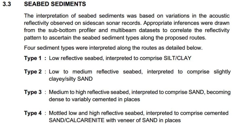
For offshore work its sidescan sonar and single and multibeam eco sounder. Different layering's can be seen from the different reflectors observed. An example of text below. We calibrate/refine these with offshore boreholes and CPTs.
uCS_z7kfhn.jpg


For onshore its MASW, cross hole or downhole is expensive and limited to 50m on plan between source and receiver. No good for long linear infrastructure.

MASW is limited to maybe 8-12m depth. Pipelines we deal with are max 5m depth so it provides good resolution over this depth.

Geophysics is by no means perfect and there is often anomalies that cant be explained. Our team is inhouse also but I am lucky that our geophysics and geotech team work in the same office. We interact a lot and have a good relationship which is key.
 
Status
Not open for further replies.
Back
Top