manholze
Civil/Environmental
- Jun 3, 2016
- 2
Hello everybody
I'm new in ths Forum and this is my first post. So if I forget to follow any Forum rules or something, please tell me.
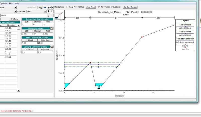
Now to my Problem. We are doing a river rehabilitation/ renaturation. In HEC- Ras we implemented the future crosssections of the river. The Problem we have, is that if we do a stady flow Simulation we get water covered areas beside the riverbed (look at attached photo). The Areas which are cover with water and do not belong to the riverbed are always lower than the riverbed, which is probably the reason for Problem. So my question: is it possible to have lower floodplains in HEC-Ras, without them be covered by water?

Thanks for your help
have a nice day!
I'm new in ths Forum and this is my first post. So if I forget to follow any Forum rules or something, please tell me.
Now to my Problem. We are doing a river rehabilitation/ renaturation. In HEC- Ras we implemented the future crosssections of the river. The Problem we have, is that if we do a stady flow Simulation we get water covered areas beside the riverbed (look at attached photo). The Areas which are cover with water and do not belong to the riverbed are always lower than the riverbed, which is probably the reason for Problem. So my question: is it possible to have lower floodplains in HEC-Ras, without them be covered by water?

Thanks for your help
have a nice day!
