As the title states, I am looking to manually verify peak elevation in pond with custom weir/orifice outlet. What are the mechanics behind how HydroCAD makes this computation? Any ideas on how I might compute this manually to prove HydroCAD is modeling correctly?
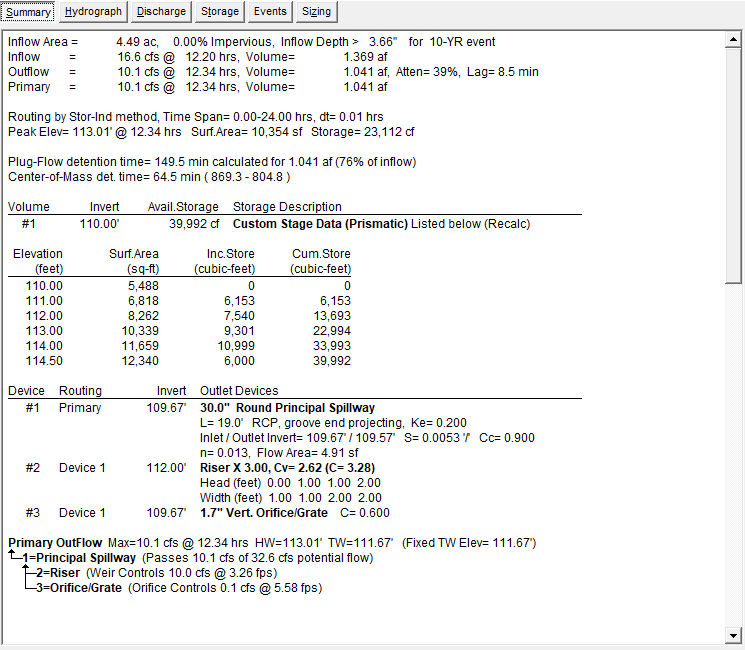
Below is the summary for my pond node:

Below is the summary for my pond node:

