Eng-Tips is the largest engineering community on the Internet

Intelligent Work Forums for Engineering Professionals

Land Development Question

Status
Not open for further replies.

gray32

Mechanical
Mar 12, 2022
1
0
0
US
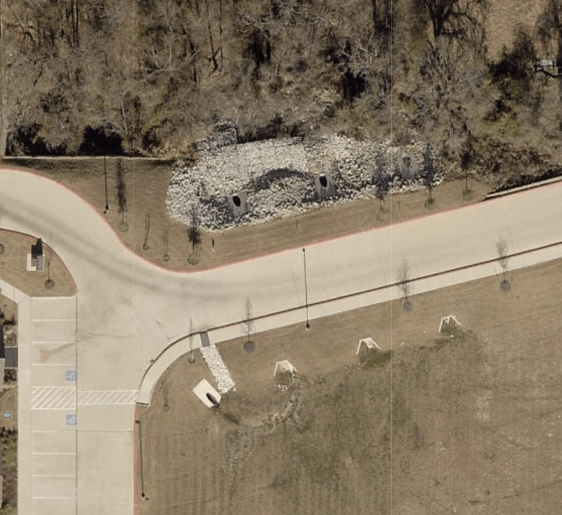
I'm looking at developing a land, but I'm afraid that not much of the land will be usable. From the image, my property is north of the fire lane. South of the fire lane appears to be a detention. An apartment complex is to the west. When the apartment complex came in, they did some work directly north of the fire lane which is part of my property. I'm not sure how this will impact me. Could anyone explain what they did here exactly?

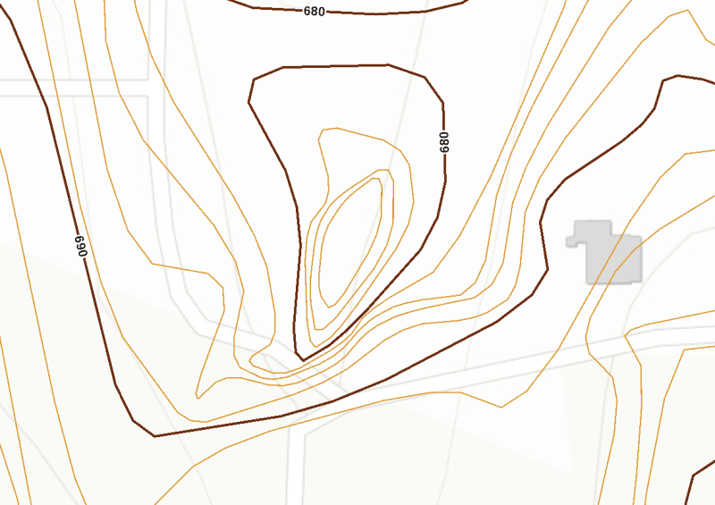
I also attached an image of the topography. Does it look like a detention on my property would be needed? I don't have too much knowledge on contour lines when they circle around. I appreciate any help, thanks!

Screen_Shot_2022-03-12_at_9.15.18_AM_psm4qq.png
Screen_Shot_2022-03-12_at_9.21.29_AM_u40m6r.png
 
Replies continue below

Recommended for you

The contour map shows a depression 16ft deeper than the intersection.

Circles are either a depression basin, or a hill or mound top.
You have to look at the elevation numbers to know which it is.
That one is a depression basin. I know that because the elevation decreases when walking toward the center. 690-680 and 674 in the center. There are 5 lines counting from 690, that's 0, to 680, that's 5. Each line is 690-680 = 10ft divided by 5 lines equals 2ft per line crossed. 3 lines crossed is 6ft. Going down towards the center of the circle fro 680 is 680-6 =674 ft elevation at the center.

The picture looks like the area has been filled in, or maybe just paved with rock. Hard to make out exactly.

A black swan to a turkey is a white swan to the butcher ... and to Boeing.
 
It's hard to tell for sure, but it looks like your topo is rotated 90 degrees CCW from your photo, based on what I assume are the roads on the topo. The topo seems to show an embankment at the top of the drawing (the second 680 elevation line closer to the top). The aerial seems to show three culverts under the road with riprap hardening on the north side. It is difficult to tell why they have three culverts, but without a larger topo you can't tell how much drainage area is contributing. Without some sort of scale, you can't tell how steep or flat the area is or how big the detention basin actually is.
 
I thought the same about the orientation at first, but the roads do match up reasonably well. It looks like a reasonable fit up. Other possible orientations don't seem to work at all. The tire tracks line up to nice a racing line through the curve on the map.


A black swan to a turkey is a white swan to the butcher ... and to Boeing.
 
It would be nice to have a topo and aeriel that were at a larger scale so that we could maybe tell what the drainage is doing. If the roads on the topo match the roads on the aerial, the only way I can see that the detention is on the southside of the road is if the topo has been rotated.
 
V difficult to work out what is what.

that grey area though to the top side of the road in the photo has all the appearance of a SUDS catchment drain.

The area to the bottom of the photo has a number of culverts and looks like a secondary catchment area.

but this is impossible to judge.

Remember - More details = better answers
Also: If you get a response it's polite to respond to it.
 
My recommendation would be to hire a planner to address the "pros" and "cons" for your site.
They would even be able to provide a sketch of the site with your development.
 
Status
Not open for further replies.
Back
Top