Eng-Tips is the largest engineering community on the Internet

Intelligent Work Forums for Engineering Professionals

  • Congratulations waross on being selected by the Eng-Tips community for having the most helpful posts in the forums last week. Way to Go!

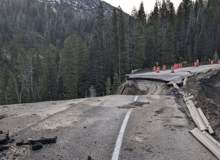
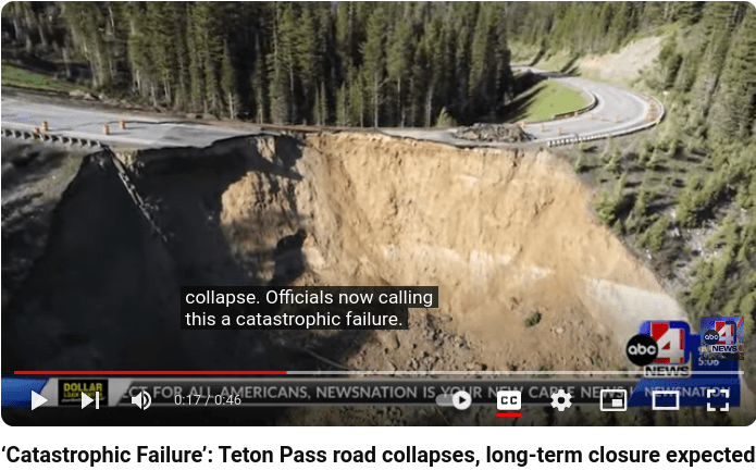
Major Highway Embankment Failure June 8, 2024

Status
Not open for further replies.

FacEngrPE

Mechanical
Feb 9, 2020
1,585
US
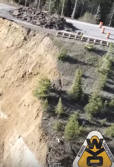
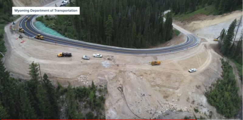
WYDOT shares video of Teton Pass landslide damage]

Commentary from Casey Jones

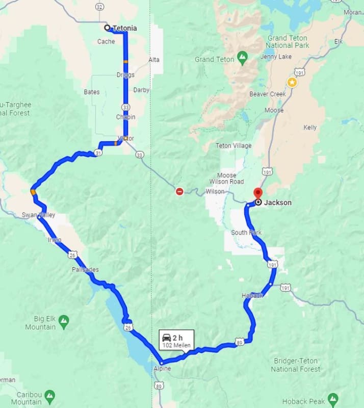
ITD assists WYDOT as travelers must detour with closure of Teton Pass
IDT said:
drivers should plan an additional 30-75 minutes of travel time between jackson hole and .

Screenshot_from_2024-06-08_20-06-39_hsp6b7.png


Screenshot_from_2024-06-09_17-53-25_jffdar.png
[pre][/pre]
 
Replies continue below

Recommended for you

Looks like some pretty steep and tall slopes on that cut and fill work.
Given the other mud flows in the area, there must have been a lot of rain and snow melt saturating the ground.
 
Yea, that's going to take awhile to repair ;-)

John R. Baker, P.E. (ret)
Irvine, CA
Siemens PLM:

The secret of life is not finding someone to live with
It's finding someone you can't live without
 
The Casey Jones video does mention the problems Jackson and many of it's workers will have. So many of the employees of the Jackson tourism/adventure/hospitality industries use this road to get to work.

I'm no expert on geotechnical engineering. But I am astounded that the Wyoming Department of transport thought they could reopen this road in a few days and that they already had works begun.

On a slope as steep as this it doesn't take a genius to see that this is a big problem.
temp_eyuz88.png
 
How dare the dirt return to the original contour of the land.

In comments on other reports is the observation that Jackson Hole is too expensive for the workers who support the very wealthy.

Wyoming offers a bonus as a tax haven for those seeking a Rocky Mountain lifestyle over other western states.

In 2019, Kiplinger rated Wyoming the #1 Most Tax-Friendly State, and Bloomberg Wealth Manager called Wyoming the most wealth-friendly state.

Why? It has some of the lowest property and sales taxes in America and no income taxes, estate taxes, no taxes on gas and groceries, no taxes on financial assets (including stocks and bonds), no taxes on the sale or gift of real estate and no taxes on out-of-state retirement income, which makes it extremely friendly for those who want to pass down their wealth. In addition to all of the tax benefits above, dynasty trusts shield real estate from federal estate taxes for up to 1,000 years. (Read more on Wyoming Tax Benefits.)

The big places have dormitories on-site. Many live in essentially group homes, like you get to share bedrooms, or have a place behind the sofa. Otherwise it's a commute.

Fortunately the Feds are going to get involved to repair it.

Here's a map of one route:
jackson_tbqnns.jpg
 
I have travelled that pass too many times to count. Went to school in Idaho and used to go to Jackson Hole to ski on weekends.
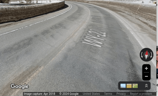
Late fall 1972, I did a spin in my 1968 VW beetle on that road near the top of the pass where it is sheer cliff up one side and down on the other. Luckily, I stayed on the road when spinning as there were no guardrails in the downhill side of the road at that time.

"Wildfires are dangerous, hard to control, and economically catastrophic."

Ben Loosli
 
looslib said:
Late fall 1972, I did a spin in my 1968 VW beetle on that road


i have been on that road circa 1980. Driggs to Jackson and on to Rock springs after ski trip in a bug. what a fun drive that was...
 
wyo-12_xs9mbg.jpg
wyo-11_a6f8zr.jpg


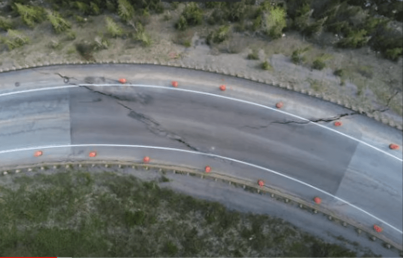
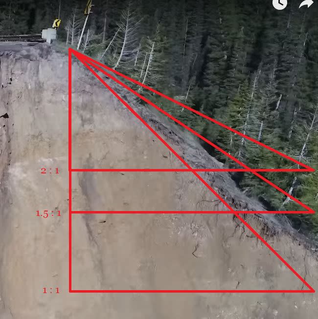
In the video assessment by Casey he said it looked like slopes were in the range of 2:1. It's hard to gauge from the drone footage, but to my eye they look a lot steeper than that. They do seem to vary as well as you move along the curve. [Edit: In Casey's second video he acknowledged that slopes appear greater than 2:1.]

Also, any fix seems to be constrained downhill by a creek as to the minimum slope they can lay without additional measures. Hard to see them proceeding successfully without some kind of geogrid or downhill retaining structure. Here's a link to short PDF put out by the Forest Service on slope stabilization. Link
 

From the image you posted, the slope of the fill appears to be inconsistent (My apologies, I repeated what you stated. In that case, I agree with you). This could be due to poor construction or years of settlement. Either way, it would only be by luck if the design parameters were being met at the steepest inclination. This road has served for many years (I believe I drove it in 1980) so I would consider this issue as a maintenance concern. Perhaps, as with much infrastructure and technology, upgrades are required.
 
[URL unfurl="true" said:
https://www.jhnewsandguide.com/news/environmental/budge-slide-expert-urges-careful-engineering-on-teton-pass-rebuild/article_dc05020a-281c-11ef-9c12-6fa7fde7b3b7.html[/URL]]Hammond said WYDOT is already contemplating some sort of “stabilization effort” in the native material underneath the “Big Fill.” It’s not yet clear what that will look like.
[ponder] This seems backwards.
 
Backwards, or maybe upside down. They are likely investigating injecting something into the material in question.
 
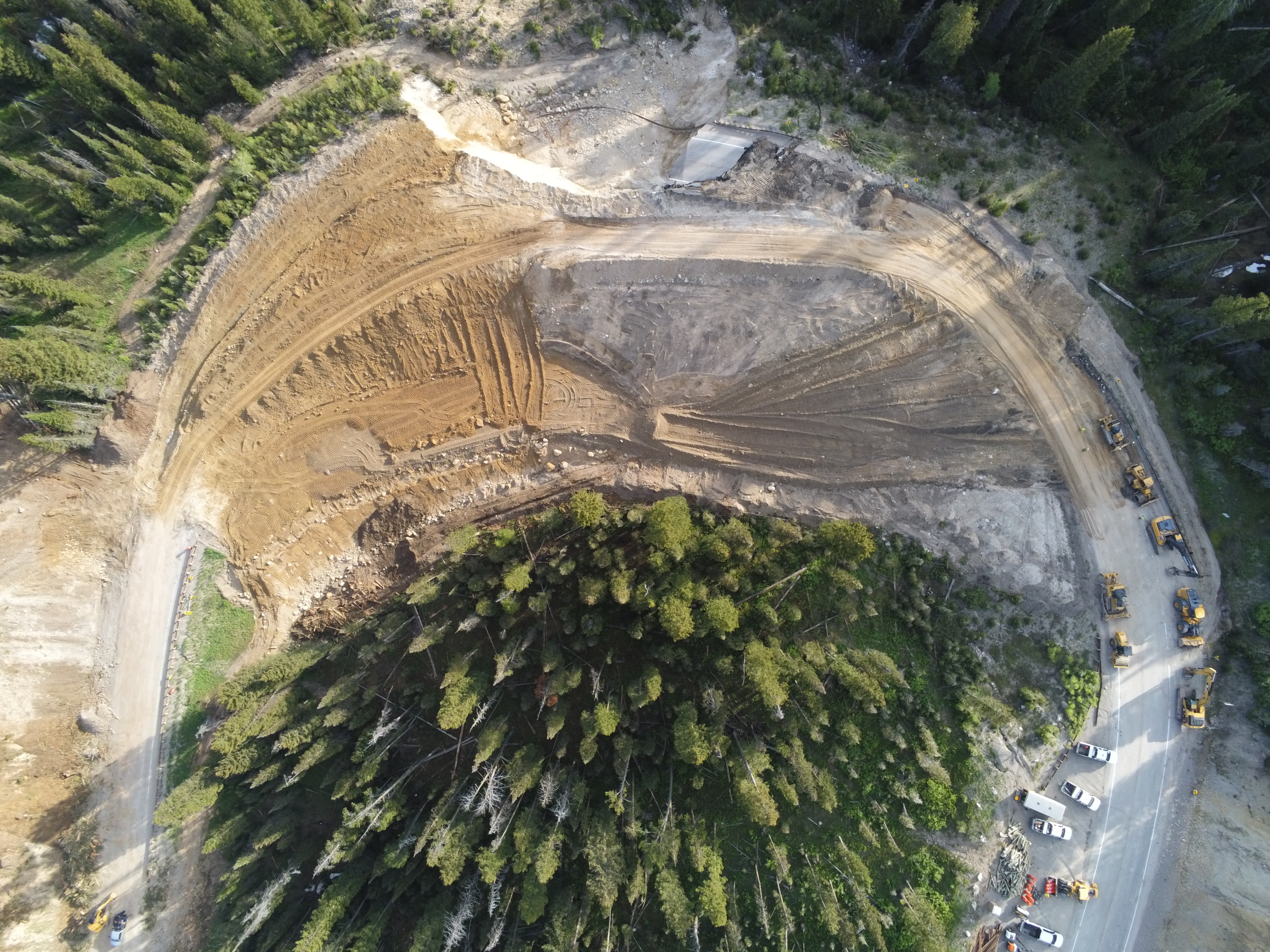
It may be a belt and suspenders approach. Rebuild the road safely, then install some ground improvement elements or compaction grouting. It’s difficult to do the ground improvement first when you have a tall scarp hanging over your head.
 
Creepy. Just throw some dirt over the side. They'll believe us if we say it was the weather.

I hope they have some good speed reduction signage since that downhill curve is now much tighter.
 
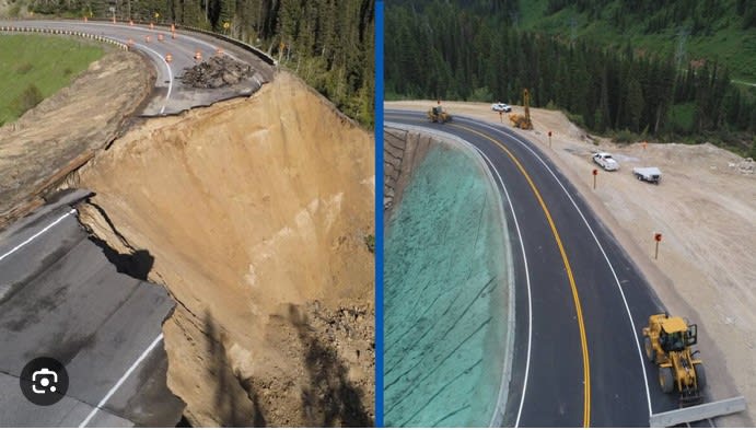
Does the hydroseed just hide the first signs of the next failure?

When one this sentence into the German to translate wanted, would one the fact exploit, that the word order and the punctuation already with the German conventions agree.

-- Douglas Hofstadter, Jan 1982
 
Status
Not open for further replies.

Part and Inventory Search

Sponsor

Back
Top