Sym P. le
Mechanical
- Jul 9, 2018
- 1,186
Maybe not the most forum related but I'll throw this up in case anyone is interested as I've already done the work. Chalk it up to March Madness.
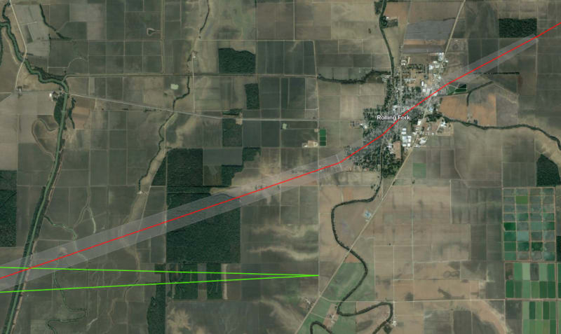
Since many disasters occur at night, the context is limited to the aftermath. I took a crop from a storm chasers video, a single frame lit from a lightning strike, and found that it scaled horizontally (and presumably vertical as well) with the Google Earth imagery (32°52'35.56"N 90°53'42.67"W). The tornado is approx. 3/8 mile wide and about 5 min. from entering Rolling Fork.
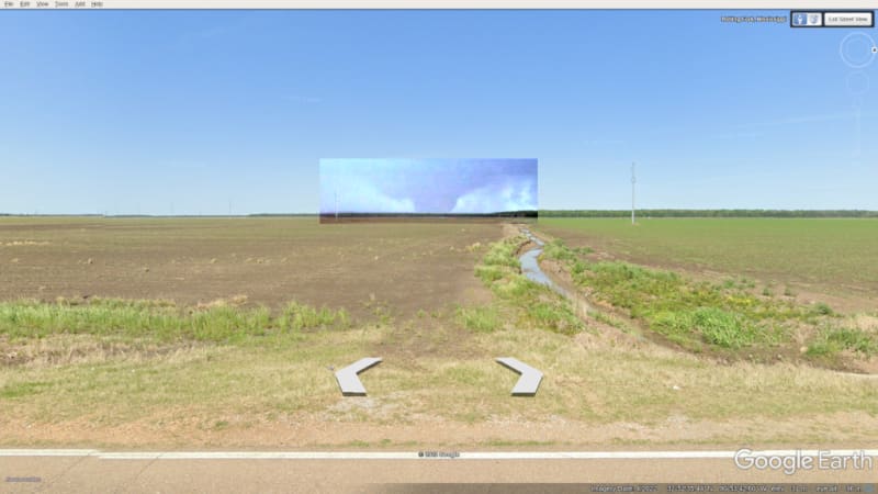
Ground track approximated from drone footage of worst case damages.
Link to Google Maps
Since many disasters occur at night, the context is limited to the aftermath. I took a crop from a storm chasers video, a single frame lit from a lightning strike, and found that it scaled horizontally (and presumably vertical as well) with the Google Earth imagery (32°52'35.56"N 90°53'42.67"W). The tornado is approx. 3/8 mile wide and about 5 min. from entering Rolling Fork.
Ground track approximated from drone footage of worst case damages.
Link to Google Maps