And another picture from 1909 that shows it was originally a standalone wall (note the windows which are filled in in the picture above to orient yourself):
This map circa 1955 shows that the wall (CONC WALL left side) was incorporated into a building which was eventually removed and replaced with fill behind the wall and parking above:
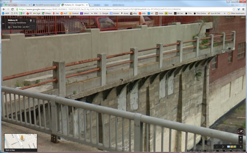
So the wall was originally designed and built to only support vertical loading, correct? If they never provided any sort of anchoring/reinforcement when they back-filled it so as to provide a parking area, this could be the real fault. Now there does appear to be some shallow 'buttresses' on the outer face of the wall that can't be seen from the 1909 photo due to it looking toward the backside of the wall, so we don't know if those were added when the back-filling was done, but even so, they don't look like they would all that much lateral support for such a tall wall.
Compare the 1955 map from Spartan5's second link with this one from 1901
The wall was apparently free standing in 1909, but that might have been for an older building that shows up in the 1901 map, and then incorporated into the building as shown in the 1955 map. After that, it was apparently left as a retaining wall when the building itself was torn down, and the sublevels filled in. The railings look similar to what's on the bridge itself in 1909, so it might have been part of the bridge design
TTFN
I can do absolutely anything. I'm an expert!
faq731-376 forum1529
![URL]](https://res.cloudinary.com/engtips/image/fetch/w_800,c_lfill,q_auto,f_auto,g_faces:center/[URL unfurl="true"]http://image.pennlive.com/home/penn-media/width620/img/news/photo/2016/05/05/20281404-mmmain.jpg[/URL])
![URL]](https://res.cloudinary.com/engtips/image/fetch/w_800,c_lfill,q_auto,f_auto,g_faces:center/[URL unfurl="true"]http://image.pennlive.com/home/penn-media/width960/img/patriot-news/photo/2016/05/06/-a3dda9244256350c.jpg[/URL])
![URL]](https://res.cloudinary.com/engtips/image/fetch/w_800,c_lfill,q_auto,f_auto,g_faces:center/[URL unfurl="true"]http://image.pennlive.com/home/penn-media/width960/img/patriot-news/photo/2016/05/06/-54ec188ce9247ba2.jpg[/URL])
![URL]](https://res.cloudinary.com/engtips/image/fetch/w_800,c_lfill,q_auto,f_auto,g_faces:center/[URL unfurl="true"]http://image.pennlive.com/home/penn-media/width960/img/patriot-news/photo/2016/05/06/-eb0ee105e01c658e.jpg[/URL])