Continue to Site

Eng-Tips is the largest engineering community on the Internet

Intelligent Work Forums for Engineering Professionals

  • Congratulations KootK on being selected by the Eng-Tips community for having the most helpful posts in the forums last week. Way to Go!

FEMA's Outdated Flood Zone Maps 21

Oops409

Mechanical
Apr 25, 2024
193
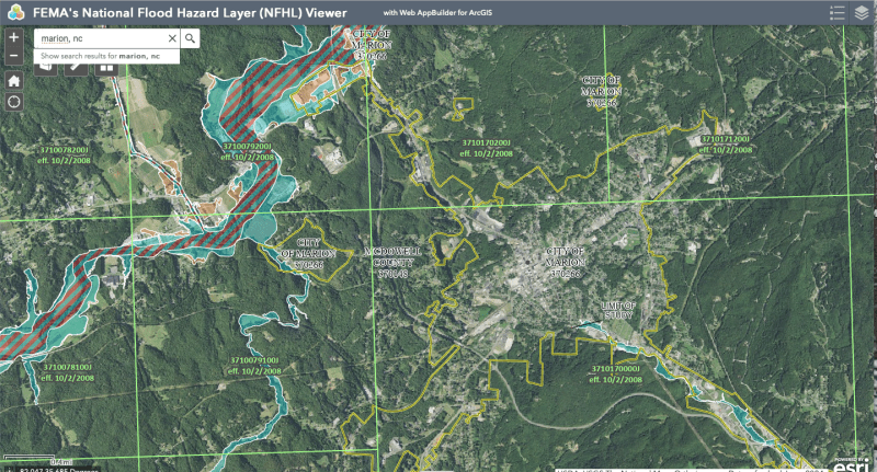
Only 3% of residents in Asheville, NC, for example, had flood insurance, according to an article I read. Looking at FEMA's Flood Maps, it is understandable why residents would not have flood insurance.

FEMA flood maps will need to be updated to reflect modern risks, and risks due to more and more urbanization and growth since maps were developed, along with whatever weather cycles we are now experiencing.
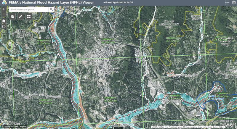
Screen_Shot_2024-10-04_at_2.44.28_PM_ufmkwl.png


Marion, NC below

Screen_Shot_2024-10-04_at_3.06.57_PM_mxaqdk.png


Replies continue below

Recommended for you

Amazing scour power. Rebuilding the railroad track bed is going to require an immense amount of fill material moved back in. The Nolichucky is quite a meandering river it will interesting to see where all scour material dropped - there must be huge sediment deposits on inner banks and into the Davy Crocket Lake at Nolichucky Dam and Dougles Lake at the Douglas Dam.
 
Good videos of train track destruction and road rebuilding. In all the video's I have yet to see an EV Charging Station........... 🌈
 
I haven't seen any fuel tankers or rebuilding of gas stations either.

If they wanted to, it would be quicker to set up solar panels and an inverter from them to charge electric vehicles.
 
No need to worry about electric vehicle chargers until the electric lines are restrung. As a number of substations were demolished, this is going to take a while.

Did Helene leave permanent geologic damage on Appalachian mountainsides?TheGeoModels, Oct 25 2024.​


Geomodels Oct 24, 2024
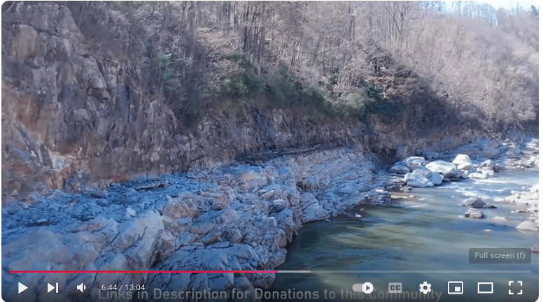
Helene produced numerous huge debris flows which roared down hollers to claim lives and destroy property. The debris flows which affected Buck Creek in McDowell County are a particularly extreme example. This video talks about what debris flows do to stream channels and the adjacent land as they move downslope. Their behavior explains why they're so dangerous--they collect boulders, soil, and trees on their way downslope, with the entire mass often moving at considerable speed and doing catastrophic damage to anything in its way. Debris flows leave "tracks" on the landscape, and they can last for quite awhile. That said, the forest recovers, and you might even live near an old one and not even know it. This video tries to put debris flows into an overall geologic context while showing what their on-the-ground scouring of the land can look like.

Debris flows are not the same as riverene flooding. Ir is a flow not of water, but of rocks, trees, bolders, wet soil with enough water to lubricate. Ir is more like sand blasting than water our of a fire hose. I

I don't think the FEMA FIRM maps or the associated technical reports deal well with this risk.

FIRM's and the associated technical reports are available from the FEMA Map Portal
 
Last edited:
No need to worry about electric vehicle chargers until the electric lines are restrung. As a number of substations were demolished, this is going to take a while.

Vunerability of electrical infrastructure to Storm Disasters, emphasizes need for portable fossil fueled autos and equipment to immediately provide 'Energy' to rebuild the electrical and other infrastructure.

Solar does not work very well in a rugged inaccessible narrow steep forested creek valley.

Solar in this environment would not provide energy required for all the vehicles and equipment required to rebuild.
They aren't arroyos that get sun for a few minutes. Ridge tops are getting plenty of unobstructed sun and the places where the towns were were not forested creek valleys. I can see those places getting sunlight, but I cannot see how they will get fuel tankers to those locations to fill the non-existent fuel stations.
 
They aren't arroyos that get sun for a few minutes. Ridge tops are getting plenty of unobstructed sun and the places where the towns were were not forested creek valleys. I can see those places getting sunlight, but I cannot see how they will get fuel tankers to those locations to fill the non-existent fuel stations.
Arroyos are more associated with dry creeks in arid regions with far different terrain than narrow Appalachia creeks in the ravines. Appalachia ravines do not get as much sun as flat desert regions due to topography.

Problem with locating Solar Panels on Ridge Tops is that those areas are frequently totally inaccessible by road, and heavily wooded and steep, requiring long switchback paths to reach.

Cost prohibited infrastructure to get solar too and along ridge tops, and "UGLY as HELL" on these beautiful rugged mountains.... Then you have to tie the solar farm into the grid, thus creating additional very vulnerable infrastructure to flash flood storms...

Fuel trucks get to these areas by way of roads along creeks and river beds in the valleys, and don't have to get to the unaccessible peaks...
 
"Appalachia ravines do not get as much sun as flat desert regions due to topography."

That explains the trees dying from lack of sunlight. /s

Anyway, we were talking about emergency response, not global climate denier arguments against solar power or long term solutions. Also, point location power production for charging electric vehicles doesn't need to be tied to any grid at all. No one has to do any such thing, but as a denial straw man.

"Fuel trucks get to these areas by way of roads along creeks and river beds in the valleys, "

Most of those roadways are gone or are so interrupted as to be impassible.

How much straw is available for more arguments?
 
Bootstraping, works faster than FEMA.

Asheville is Worse than We Realized - Can They Rebuild? Project Atticus

Solar power requires sun. It could be a partial solution, but I doubt there are many locations in the deep hollows with enough sun time to make the economics work. Bringing in solar panels quickly and installing them following a natural disaster is even harder than trucking in fuel.

This fuel cube - with pump costs $5,000. Uses a small pump, which could be run by just about any power source.
Can be quickly trucked in and set up, just about anywhere.

Try trucking in 250 gallons of electrons. (container of batteries?, likely too heavy for the roads. More likely electric car chargers will follow the restringing of electric service.)
114909_1.jpg
 
Last edited:
"How do we manage risk in earthquake zones? We don't try to stop slow the motion of the techtonic plates."

We design to accommodate the seismic forces expected. Some critical infrastructure should not be constructed is seismic areas, or extra care should be taken. Note to engineers, "Do not build a nuclear facility on an active seismic fault." I seem to recall there were problems with this type of construction in Japan.
 
"Bringing in solar panels quickly and installing them following a natural disaster is even harder than trucking in fuel."

Some BEVs are being sold that can connect and add to the power grid; I think the Ford F150 Lightning is one.
 
Bootstraping, works faster than FEMA.

Asheville is Worse than We Realized - Can They Rebuild? Project Atticus

Solar power requires sun. It could be a partial solution, but I doubt there are many locations in the deep hollows with enough sun time to make the economics work. Bringing in solar panels quickly and installing them following a natural disaster is even harder than trucking in fuel.

This fuel cube - with pump costs $5,000. Uses a small pump, which could be run by just about any power source.
Can be quickly trucked in and set up, just about anywhere.

Try trucking in 250 gallons of electrons. (container of batteries?, likely too heavy for the roads. More likely electric car chargers will follow the restringing of electric service.)
View attachment 192
How does one truck them where there aren't roads anymore? Sure, use the train tracks that don't exist.
 
 
Last edited:

FEMA FIRM's generally assume floods are defined by a free pond elevation. For debris flow, the flow energy makes the free pond elevation almost not relevant. The linked video includes examples in the field of both the trigger areas, and some locations where the flow overshot the pond elevation by as much as 60 feet.


TheGeoModels Nov 9 2024
Off-the-phone video of some of Helene's largest debris flows with geologist Philip Prince...you may have seen these flows in another video, but I wanted to talk about some of the geologic details. These very, very extreme, and likely reflect catastrophic upslope rainfall onto a specific bedrock and soil geology. This video is intended to supplement my videos and drawings that are already posted.
 
How do you rebuild a railroad?

Widespread damage was seen along the right-of-way between milepost Z 138.0 at Erwin, Tenn., to Spruce Pine, N.C., at Z 182.0, a distance of 44 miles. An approximate 375-foot bridge crossing the Nolichucky River at Poplar is gone, with only concrete piers protruding from swollen muddy waters. The railroad follows the banks of the Nolichucky and North Toe rivers for about 40 miles between Erwin and Spruce Pine. Source Link

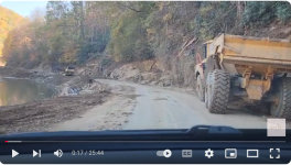
PART 1: CSX is Rebuilding the Clinchfield ~ THE DESTRUCTION THEY WILL FACE 11/6/2024​

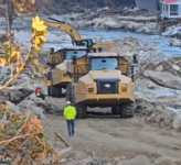
PART 2: Rebuilding the Clinchfield ~ BIG TOYS 11/14/2024​

Step 1 Big Machines - build a road.
Step 2 Bigger machines - build a railroad
Lots of seat of the pants engineering to get things moving. Come back later with engineered solutions.

I saw this happen to the CSX between Newport News and Richmond after Isabel. Washed out culverts were replaced with ballast rock as fill, culverts were installed later after the track was in service.
 

Part and Inventory Search

Sponsor