Eng-Tips is the largest engineering community on the Internet

Intelligent Work Forums for Engineering Professionals

Oroville Dam Spillway Concrete Failure (Feather River Flooding, CA) 36

Status
Not open for further replies.

msquared48

Structural
Aug 7, 2007
14,745
0
0
US

Erosion has created a 300-foot-deep hole in the concrete spillway of Oroville Dam and state officials say it will continue grow.
State engineers on Wednesday cautiously released water from Lake Oroville's damaged spillway as the reservoir level climbed amid a soaking of rain.

Situated in the western foothills of the Sierra, Lake Oroville is the second-largest manmade reservoir in California after Shasta....

Member Spartan: Stage storage flow data here for those interested:

Mike McCann, PE, SE (WA)
 
Replies continue below

Recommended for you

Yes, crane in and out. The crane counterweights are just barely visible off the left side of one of the spillway top views.
You can see it in the drone picture they took a few weeks ago:


KG_oroville_drone_23207_05_06_19_1_du07ds.jpg
 
The Oroville reservoir is currently at 891 feet, approximately nine feet below the maximum capacity before it would breach the top of the emergency spillway. While the item below is a week old, it does help explain why the reservoir has continued to see its levels raise:

California will get snow and possibly two months worth of rain from back-to-back-to-back 'atmospheric rivers'


John R. Baker, P.E. (ret)
EX-Product 'Evangelist'
Irvine, CA
Siemens PLM:
UG/NX Museum:

The secret of life is not finding someone to live with
It's finding someone you can't live without
 
Up a foot in a couple of days..

Thanks Craig! Great sleuthing.

From that drone picture I'd never seen that red barrier across the lake before. Even when I launched a boat into lake. Seems like it would impair boat launching now.

Just looked at Google Maps imagery and the red float line has been there since the old pre-excitement satellite image.

Wow they've concreted a bunch of acres of that emergency overflow haven't they.

Keith Cress
kcress -
 
Looks like they're really trying to top-off the Oroville Reservoir. As seen in the data below, the lake level is less than five feet from being absolutely full and it's still rising several inches per day.


John R. Baker, P.E. (ret)
EX-Product 'Evangelist'
Irvine, CA
Siemens PLM:
UG/NX Museum:

The secret of life is not finding someone to live with
It's finding someone you can't live without
 
Perhaps after the 2017 debacle they are taking advantage of the weather conditions to allow flow over the emergency spillway, to confirm the expected performance?

Brad Waybright

It's all okay as long as it's okay.
 
I don't think there is any intention to ever 'test' the emergency spillway, it will only be used again if there is an actual emergency.
While they did armor the hillside immediately below the weir, it is not armored all the way to the river below and there will be erosion and silting into the river if it is ever used.

What they are doing right now is 'filling it up'. They still have almost 80K acre-feet of 'room' in the storage pool.
 
Yes, logically speaking, the last few feet of lake level represents an inordinate amount of storage capacity. That being said, they're still getting rain in the Oroville area, better than a 1/10 of inch in the past 24 hours alone. Now a 1/10 of an inch may not sound like much, but keep in mind that this is still California and it's nearly June, well past our normal rainy season.

John R. Baker, P.E. (ret)
EX-Product 'Evangelist'
Irvine, CA
Siemens PLM:
UG/NX Museum:

The secret of life is not finding someone to live with
It's finding someone you can't live without
 
Lots of spillway news...

1) DWR has announced that they might use the FCO (regular spillway, NOT the emergency spillway) again this year:


2) They have cranked up the outflows through the power plant again and the level has dropped a bit in the last day or so:


3) The independent board of consultants released their report on their observations after the first use of the spillway:


Lots of good stuff in there, including seeing basically no flow from the underslab drains.

Here's the TL;DR:

"The recent FCO spillway flow which occurred as planned, showed that the efforts of the past two years have been successful. The design process was transparent, with input provided by all stakeholders (owner, designers, regulators and the construction contractor). The BOC believes this is a world-class project that will give the State of California many years of uneventful service. "

But I am sure the so called 'experts' who've never even visited the dam will continue to claim it is in danger of imminent collapse...
 
Fun looking at the various activities going on at the spill gates.

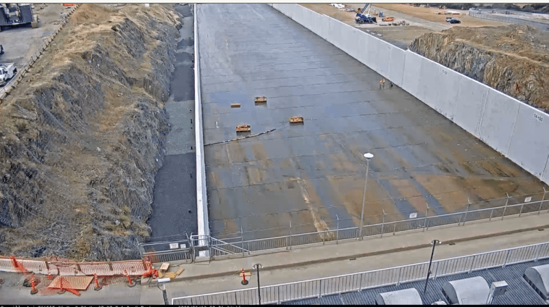
They've removed both the sandbag dams! Water now leaks fairly uniformly down the spillway.

Top View that changes every ~20 seconds

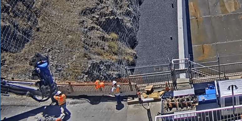
To the right they've completely finished stuff. Where a big compressor sat is now gone. There are serious guardrails and high strength fence installed.

To the left I think they're drilling for more guard rails. The only thing moving in the entire close-left view was the coupling on the drill at ground level.

The E-spill way looks ready to go!

I am surprised that it looks like e-spill is going to be hitting the right side main-spill wall. I'd think they'd not want that particular interaction to ever happen.

Left_camera_2_flwulr.png


Keith Cress
kcress -
 
DWR released a video today that has a drone flyover of the new Emergency Spillway that should make the geometry clearer. The water is channeled down into two main outlets. The video also shows some construction shots of the pours they did to create a transition section from the existing weir to the new RCC 'armoring' of the hillside.

 
Status
Not open for further replies.
Back
Top