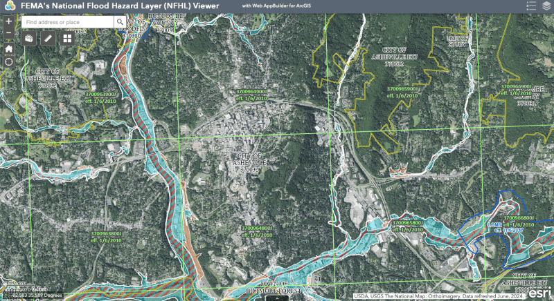
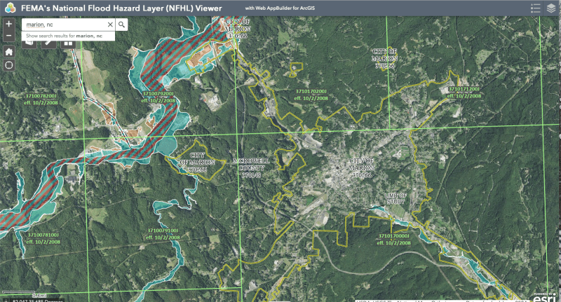
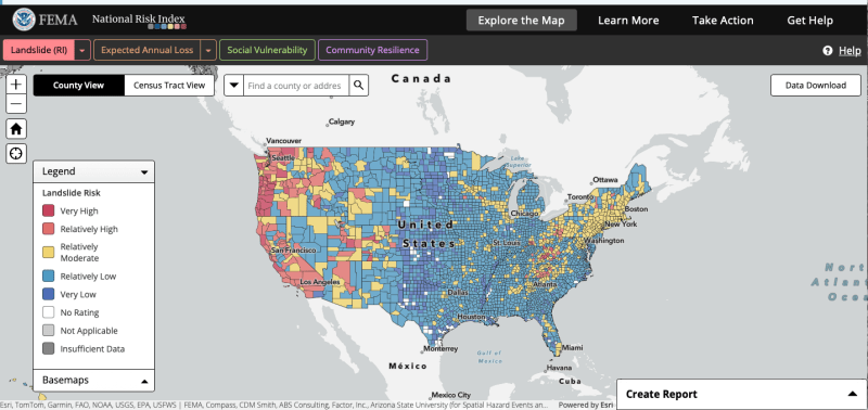
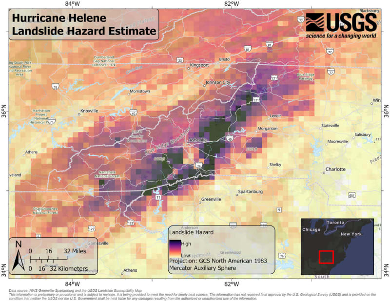
We do a simple separate slope stability analysis when planning pipeline routes in mountainous areas. Initially any slope between 15° and 40° is set for rerouting. If an easy alternate route is available, we go with that alternate. If not available a more formal and specific analysis will be undertaken. Its not only landslides we look at. Of course flood maps are studied when available, but they are usually not where I work, as well as sinkholes in karst areas, fault lines, active and inactive, water well locations, aquifers, surface reservoirs and irrigation features, rivers, streams, wet lands, crops in the fields, permafrost in Arctic regions, erosion potential, lava flow near volcanos, scour depths at beach crossings, anchorage areas, liquifaction potential in earthquake areas, undersea slides, population centers, house locations, schools, churches, prisons, 4 story and above buildings, shipping lanes, designated fishing zones, other pipelines, electric cables, telecom cables, rail routes and yards, truck delivery locations, work camps, roads and highways, present and future, critical species habitats, national parks and recreation areas, scenic views, even locations of sacred trees, mines and munitions, archaeologic and cultural heritage sites, cemetaries and burial sites, one time Elsie the Lion's site was marked out, among other things as necessary, are all run through the hopper before a preliminary route is bracketed in. Floods are only one small bit of the routing and site study. It's all loaded up into GIS program for delineation and as backup data for the selected route. In the end, we know the location of everything, past, present and future.
--Einstein gave the same test to students every year. When asked why he would do something like that, "Because the answers had changed."