Continue to Site

Eng-Tips is the largest engineering community on the Internet

Intelligent Work Forums for Engineering Professionals

  • Congratulations KootK on being selected by the Eng-Tips community for having the most helpful posts in the forums last week. Way to Go!

Oroville Dam Spillway Concrete Failure (Feather River Flooding, CA) 36

Status
Not open for further replies.

msquared48

Structural
Aug 7, 2007
14,745

Erosion has created a 300-foot-deep hole in the concrete spillway of Oroville Dam and state officials say it will continue grow.
State engineers on Wednesday cautiously released water from Lake Oroville's damaged spillway as the reservoir level climbed amid a soaking of rain.

Situated in the western foothills of the Sierra, Lake Oroville is the second-largest manmade reservoir in California after Shasta....

Member Spartan: Stage storage flow data here for those interested:

Mike McCann, PE, SE (WA)
 
Replies continue below

Recommended for you

Very high snowfall in the Sierra Mountains this weekend, but those come after a low Feb snowfall.
 
It's been awhile since we've had an update from Juan Browne. This one appears to be the most recent, from July 14th:


John R. Baker, P.E. (ret)
EX-Product 'Evangelist'
Irvine, CA
Siemens PLM:
UG/NX Museum:

The secret of life is not finding someone to live with
It's finding someone you can't live without
 
Yes, liquid nitrogen is a common tool in hot weather concreting.
 
Gentlemen,
Among other things Oroville Browne flys from time to time as a fire bomber pilot, I think he has had his hands full this year. He has also produced some videos on the wild fires.
B.E.

You are judged not by what you know, but by what you can do.
 
It will be interesting when the Spring thaw and runoff starts as we may get a chance to see if the repairs and upgrade of the Oroville Dam were adequate:

Atmospheric rivers are pulling California out of drought and piling on the snow


John R. Baker, P.E. (ret)
EX-Product 'Evangelist'
Irvine, CA
Siemens PLM:
UG/NX Museum:

The secret of life is not finding someone to live with
It's finding someone you can't live without
 
The only live Oroville Dam Data I know of

The resivoir was 20 feet above the spillway gates and now N.CA is getting some moderate rain.

I'm trying to figure out if the spillway is in use.

The only relevant sensors I think could be related are, sensors 23 and 85. Note that 23 is used in two locations and they don't look the same!
One looks very much like generators being put into service and removed but the other?

85 looks more like a spillway event to me but I'm only guessing.

Keith Cress
kcress -
 
It appears the two sensor 23's are indeed the same sensor...one item is reporting hourly outflow, the other daily. Looking at the data, there is a comments field near the top which states in part:

"Outflow from Oroville includes all releases from the Oroville Dam (i.e.: Hyatt, spillway, low flow outlet)..."

So, sensor 23 does not deal exclusively with the spillway. Sensor 85, based on the comments section, appears to pertain to the Dam Diversion gates and Thermalito Afterbay River Outlet rather than the spill way.

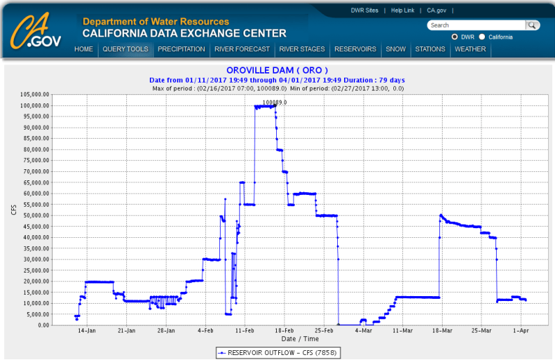
To confirm the spillway is in use, I would expect we'd need to see a "sudden" rise in the overall Outflow measured. Stepping back in the historical data to 2017, it appears the outflow was measured upwards of 20,000 CFS when the spillway was in use.

Good find, itsmoked, very interesting!
 
I posted this back in 2017 as well as in the other thread.

KoachCSR said:
To confirm the spillway is in use, I would expect we'd need to see a "sudden" rise in the overall Outflow measured. Stepping back in the historical data to 2017, it appears the outflow was measured upwards of 20,000 CFS when the spillway was in use.

Running full-tilt-boogie during the failure, total flows were around 100,000 CFS. I think that the max flow without the gates being open is around 9,000 CFS.

2019-03-20_22_54_18-CDEC_-_Data_Application_bzizan.png
 
Thanks Spartan, Koach. I just read where they want the depth to be 848ft by the end of March and want to keep it up
around there for spring. So. With the level at 840 it seems they probably won't open the gates unless something really does
happen to bring on a lot more water.

Interesting that 98 cubic feet per second (730gal/sec) are leaving as evaporation.

Keith Cress
kcress -
 
Let's be careful with wording. 848 ft is an elevation above sea level, not a depth.
 
Is there a specific reason the spillway doesn't run all the way to the river below? I have zero expertise which is probably obvious from this question, but it seems like using the spillway for any length of time would obliterate the road and shoreline of the river, and result in a new construction project every time the spillway is used above a trickle.
 
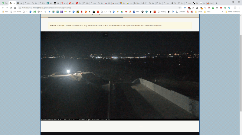
I thought those cameras weren't working either, but if you wait a minute or so, after hitting the 'play' button, they eventually come-up.

John R. Baker, P.E. (ret)
EX-Product 'Evangelist'
Irvine, CA
Siemens PLM:
UG/NX Museum:

The secret of life is not finding someone to live with
It's finding someone you can't live without
 
Status
Not open for further replies.

Part and Inventory Search

Sponsor